Strong earthquake of magnitude 7.1 struck Bali Sea, Indonesia

A powerful earthquake of 7.1 magnitude on the Richter scale occurred in the deep sea to the north of the Bali and Lombok islands in Indonesia early on Tuesday. This information was conveyed by the European-Mediterranean Seismological Centre (EMSC).
The earthquake's epicenter was located 203km north of Mataram, at a significant depth of 516km beneath the Earth's surface, as reported by the EMSC. Both Indonesian and U.S. geological agencies assessed the magnitude as 7.1, assuring that there was no danger of a tsunami.
The quake was felt shortly before 4 a.m. (20:00 GMT) in the coastal regions of Bali and Lombok while two earthquakes with magnitudes of 6.1 and 6.5 were followed, as stated by the Indonesian geological agency.
The Indonesian disaster agency, BNPB, confirmed that there were no immediate reports of damage. Abdul Muhari, a spokesperson for BNPB, assured that due to the earthquake's depth, significant damage was not expected.
Sources: reuters.com, aa.com.tr, crisis24.garda.com
Media
- 7.1 Magnitude Earthquake Strikes North of Bali and Lombok Islands | OneIndia News
- Indonesia hit by magnitude 7.0 earthquake in Bali Sea | 9 News Australia
Want to read more like this story?

7.6 magnitude quake hit Indonesia: tsunami warning lifted
Jan, 10, 2023 | NewsAn earthquake of magnitude 7.6 struck Indonesia (Tanimbar islands) on Tuesday prompting panicked re...

5.8-magnitude earthquake strikes Ecuador coast: damaged buildings, huge loss of property, no tsunami
Mar, 28, 2022 | NewsA huge loss of property was suffered when an earthquake of magnitude 5.8 struck Ecuador coast on Sa...

6.4-magnitude earthquake hit eastern Indonesia
Jan, 10, 2026 | NewsA strong earthquake measuring 6.4 on the Richter scale struck eastern Indonesia late on Saturday, a...

6.6-magnitude earthquake shakes Indonesia’s capital: buildings collapsed, no tsunami alert
Jan, 14, 2022 | NewsParts of Indonesia’s main island of Java were shaken by a powerful earthquake of 6.6-magnitude on F...

6.9-magnitude earthquake hit Kermadec Islands in New Zealand
Mar, 04, 2023 | NewsThe Kermadec Islands area of New Zealand was hit by an earthquake on Saturday with a magnitude of 6...
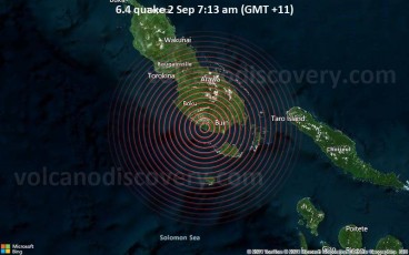
A 6.4 magnitude earthquake struck in Papua New Guinea on Monday morning
Sep, 02, 2024 | NewsA strong (6.4 magnitude) earthquake hit the Bougainville Island in Papua New Guinea at approximatel...

Magnitude 5.5 earthquake hit southern Turkish province of Adana
Jul, 25, 2023 | NewsA magnitude 5.5 earthquake struck the southern Turkish province of Adana. This recent quake occurre...

11 strongest earthquakes worldwide over the last 2 centuries
Jul, 11, 2024 | NewsIt is estimated that at least 20,000 earthquakes occur every year worldwide due to the movement of...

Indonesia: 6.6 magnitude earthquake strikes the eastern region
Apr, 09, 2024 | NewsOn Tuesday 9th of April at 09.48 GMT, Indonesia's eastern region experienced a 6.6 magnitude earthq...
Trending


4.1 magnitude earthquake in Nice, France raises concerns among authorities

Tall building fire safety in 2026 using AI, BIM and arson research

Altair will be the tallest residential towers in Sri Lanka

The tallest structure in Indiana: 1,132 feet tall