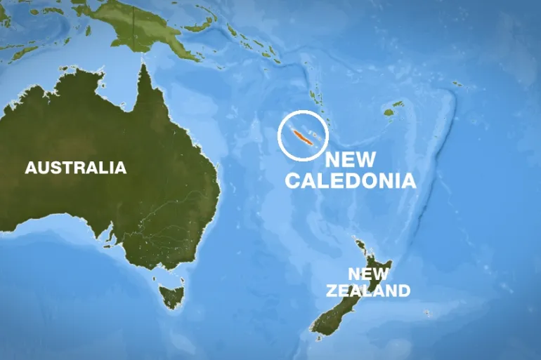
A strong earthquake of 7.7-magnitude struck the South Pacific

Sources: voanews.com, aljazeera.com
Media
- 7.7 magnitude earthquake causes small tsunami on South Pacific islands
- 7.7 magnitude earthquake prompts tsunami warning in South Pacific
Want to read more like this story?

New Caledonia: tsunami warning passes after a 7.0 magnitude earthquakes
Mar, 31, 2022 | NewsA 7.0-magnitude earthquake struck east of the French territory of New Caledonia on Thursday, the US...

Two significant quakes struck offshore Russia's Kamchatka: the initial warning for tsunami threat was later lifted
Jul, 20, 2025 | NewsTwo significant earthquakes struck offshore near Russia's Kamchatka Peninsula on Sunday. The larger...

Magnitude 8.8 earthquake shook Russia: no fatalities - tsunami waves within Pacific Ring
Jul, 30, 2025 | NewsOn Wednesday, July 30, a strong 8.8 magnitude earthquake rattled Russia. According to the U.S. Geol...

A 5.6 magnitude earthquake struck New Zealand: no reports of major structural damage
Sep, 20, 2023 | NewsNew Zealand experienced a magnitude 5.6 earthquake on Wednesday morning, with no reports of signifi...

Indonesia: 6.6 magnitude earthquake strikes the eastern region
Apr, 09, 2024 | NewsOn Tuesday 9th of April at 09.48 GMT, Indonesia's eastern region experienced a 6.6 magnitude earthq...

Earthquake strucks Alaska with 8.2 magnitude, The US National Tsunami Warning Center issued warnings for Tsunami
Jul, 29, 2021 | NewsA huge magnitude 8.2 earthquake struck Alaska, on Wednesday July 28th 8:15 p.m., 91 kilometers (56...

11 strongest earthquakes worldwide over the last 2 centuries
Jul, 11, 2024 | NewsIt is estimated that at least 20,000 earthquakes occur every year worldwide due to the movement of...

7.6 magnitude quake hit Indonesia: tsunami warning lifted
Jan, 10, 2023 | NewsAn earthquake of magnitude 7.6 struck Indonesia (Tanimbar islands) on Tuesday prompting panicked re...

Powerful 7.3 magnitude earthquake struck off Indonesia's eastern coast
Dec, 14, 2021 | NewsA powerful earthquake of 7.3-magnitude struck off Indonesia's eastern coast on Tuesday, according t...
Trending

Spectacular interchanges around the world

New Release - STAAD.Pro 2024 - 2

ADINA 2025 for Structural WorkSuite

ADINA 2025 New Release!

Drilled Shafts Project on Gilbert Road Bridge

Glass cafe at 2,600 feet in the air: it opens on world's tallest bridge


